A Historical Walk Through Gyeongju City: From Cheonmachong Tomb to Donggung Pala


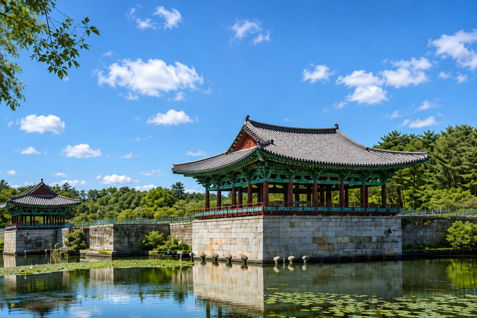
In the heart of Silla, the capital city of a thousand years, lies Seorabeol. Within walking distance, you can find the massive burial mounds where kings and royalty rest, the stone pagodas used for observing the stars, and the sites of the palaces where banquets were held. This is Gyeongju, a historic site in the city center, where you can experience the diverse landscapes of different eras in a single area.
This guide focuses on what to see at each location, the details to observe closely, and the natural flow of the route and viewing order. Please use it as a visual guide instead of a map.
Gyeongju Daereungwon — Cheonma Tomb, Hwangnamdae Tomb, Michu King Tomb
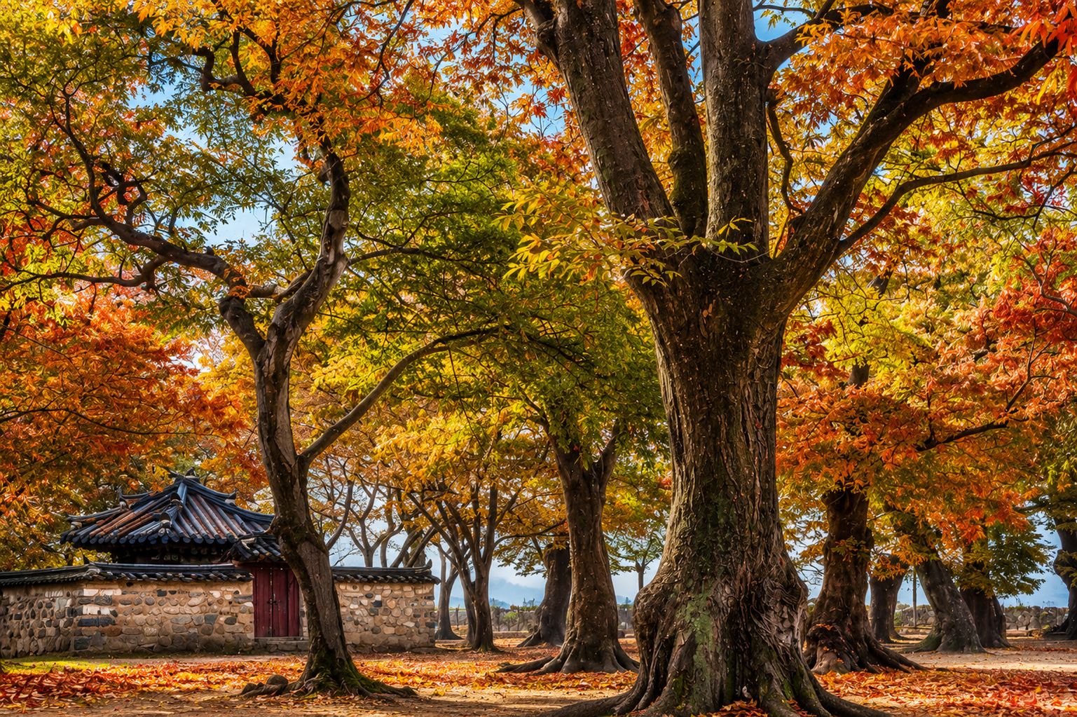
Daereungwon is a burial complex covering approximately 126,500 square meters, where 23 tombs of Silla royalty are located. In the Hwangnam-dong area, numerous large and small tombs are clustered together, and Daereungwon is the entrance and core area of this vast burial complex. Each mound has a different height and volume, creating a series of curved ridges on the plain. Beyond the walls, tall pine trees and dirt paths connect the mounds.
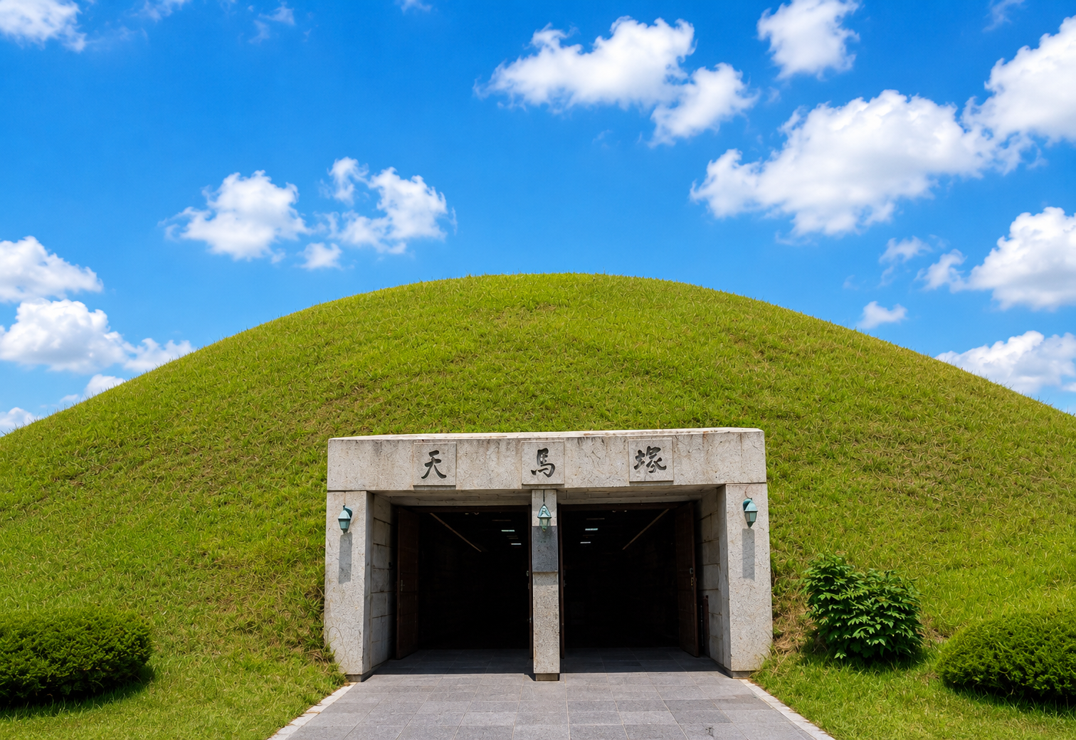
The highlight of the visit is the Cheonma Tomb. It is the only tomb in Daereungwon that has been opened to the public as an exhibition hall. Inside the mound, which is 47 meters in diameter and about 12.7 meters high, you can directly see the cross-section of the stone-lined tomb. The unique Silla structure, where wooden planks are placed on top of each other, river stones are piled up, and then the mound is covered with soil and clay, is revealed along with a cross-sectional model, allowing you to visually identify the layers and see where the wooden structure ends and the stone mound begins.
Inside the exhibition hall, the arrangement of the burial goods has been recreated. During the excavation in 1973, over 11,500 artifacts, including a gold crown, a gold hat, a feather-shaped ornament, a gold belt, and gold bronze shoes, were discovered in this tomb. A replica of the Cheonma, which is the origin of the tomb's name, is also on display. Take a closer look at the lines and the depiction of the mane in the painting of a white horse soaring into the sky on birch bark.
After leaving the Cheonma Tomb, you will see another massive mound beyond the trees. Hwangnamdae Tomb is a gourd-shaped double tomb, measuring approximately 120 meters north-south, 80 meters east-west, and 23 meters high. It is the largest tomb in Daereungwon. The two mounds are joined together, creating a single outline. If you look at it from the side at an angle, you will immediately understand why it is called a gourd-shaped tomb. Find the point where the ridge of the mound extends the longest and stop to capture the curves of the double tomb in a single frame.
- Cheonma Tomb — Tomb with open interior, exhibition of the cross-sectional structure of the stone-lined tomb and excavated artifacts, replica of Cheonma
- Hwangnamdae Tomb — Gourd-shaped double tomb, approximately 120 meters north-south, the largest mound in Daereungwon
- Michu King Tomb — A rare tomb with a known owner, the site associated with the legend of the "Bamboo Leaf Army"
The route starts at the back gate, where you can first see Cheonma Tomb on the right. Then, walk around Hwangnamdaechong Tomb and head towards the direction of Michu King's Tomb. This route feels natural. Michu King's Tomb is said to be the tomb of Michu, the 13th king. Legend has it that when enemy soldiers invaded, soldiers with bamboo leaves in their ears appeared and saved Silla. Therefore, it is also called Jukhyeonling (Bamboo Appearance Tomb) or Jukjangling. Unlike other burial mounds, the area in front of the tomb is divided by a wall and a gate. It is interesting to compare it with other tombs and see how it differs. The dirt path between the mounds and the shade extend long, making you naturally slow down as you walk between the tombs.
Gyeongju Cheomseongdae and the Flower Garden of the Eastern Historic Site Area
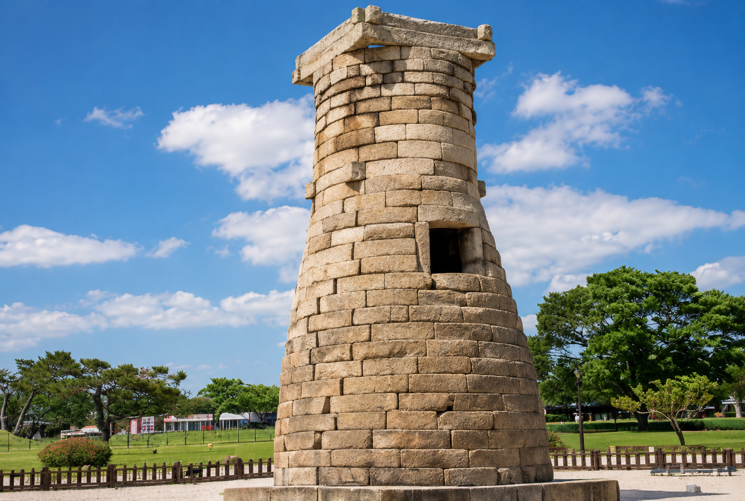
Cheomseongdae is the oldest existing astronomical observatory in the East, said to have been built during the reign of Queen Seondeok of Silla (632-647). It is approximately 9.17 meters high, with a base diameter of 4.93 meters and a top diameter of 2.85 meters. It has a shape that is round at the bottom and square at the top. The structure is largely divided into a foundation, a cylindrical part that is swollen like a wine bottle, and a well-shaped stone at the top.
If you approach it, you can see the cylindrical part, which is made by stacking 27 layers of fan-shaped stones. The number 27 is sometimes interpreted as being related to the fact that Queen Seondeok was the 27th ruler of Silla. There is a square opening on the south side of the 13th to 15th layers, where people can enter and exit. Long stones are placed in a well shape on the 19th and 20th layers and the 25th and 26th layers to firmly support the upper part. Unlike the smooth outer surface, the inside shows the back of the stones, making the surface uneven. Try walking around it, starting from the opening, and observe the differences between the inside and the outside.
The flat area of the Eastern Historic Site Area surrounding the tower is decorated with flower gardens that change color with the seasons. In spring, canola flowers form a yellow belt, and in summer, poppies, zinnias, and sunflowers fill the fields in turn. In autumn, pink muhly grass creates a pink wave. The pink muhly grass usually reaches its peak between the end of September and the middle of October. To capture the scene of the stone tower rising beyond the pink meadow, it is best to face the tower with the western sunset behind you at dusk. First, find a place with a clear view, decide on the direction you will walk, and then move so that you do not lose the composition even in the crowd.
The area around Cheomseongdae is the heart of the Silla historical site. To the southwest is the site of Wolseong, which was the royal palace of Silla, and next to it is the old forest of Gyerim, where the legend of Kim Alji's birth is told. To the east are the East Palace and Wolji Pond, which are not far away. If you start from Cheomseongdae, cross the flower garden, and walk to the East Palace and Wolji Pond via Gyerim, you can connect the astronomical observatory and the palace in one walk.
The East Palace and Wolji Pond - The Night Palace and Corridor
The East Palace and Wolji Pond are the sites of a palace of the Silla royal palace. It was a place where the crown prince resided and where banquets were held when there were auspicious events in the country or when important guests were received. It is said that the pond (Wolji) was dug in 674, the 14th year of King Munmu's reign, and the East Palace was built in 679, after the unification of the Three Kingdoms. After Silla collapsed, the pond became a ruin, and only ducks and geese inhabited it. During the Joseon Dynasty, it was called Anapji (Goose-Duck Pond) because it was written with the characters for goose (An) and duck (Ap). The fact that the original name was Wolji was confirmed by the letters on pottery fragments that were later excavated.
In 1975, an excavation was conducted after draining the water from the pond, revealing 26 building sites, including the site of the veranda. Among them, three pavilions were restored, along with the site presumed to be Imhaejeon, giving it its current appearance. At that time, approximately 30,000 artifacts were unearthed, including the Jureunggu (a 14-sided die with six square faces and eight hexagonal faces), a gilt bronze triad Buddha statue, and gilt bronze scissors. A significant portion of the excavated artifacts can be seen at the Anapji Pavilion of the Gyeongju National Museum, so it is recommended to view them while imagining the buildings by the pond and the objects found inside.
The viewing experience is completely different during the day and at night. When the sun is still out, it is good to clearly observe the perimeter of the pond and the wooden structure of the restored pavilions. As it gets dark, the lighting illuminates the painted decorations, and another pavilion appears to float on the water. A recommended route is to start at the entrance and walk along the east side of the pond, passing the three restored pavilions in order, and look at the pond through the eaves and between the pillars. When standing by the pond, the outline of the pavilions and the light from the painted decorations are reflected on the water surface, creating a symmetrical image above and below. The closer you are to the water's edge, the clearer this reflection becomes. If you choose a time when the wind has died down and the water surface is calm, the symmetrical lines will be even more distinct.