A journey across three time zones, from Seoul Elevated Road to Gyeongju Tumuli a
Starting from Seoul and heading southeast through Gyeongju, the ancient capital of the Silla Dynasty, and then to the port city of Busan, this route showcases a variety of attractions. These include an elevated walkway that repurposes an urban highway, a garden filled with ancient tombs where Silla royalty rest, and a hillside village with houses built in tiers. Each location represents a different era: the 20th-century urban infrastructure, the burial customs of Silla around the 5th century, and the residential style during the Korean War. Within a single journey, you can experience the 1970s concrete elevated road, the 1,500-year-old stone tomb, and the 1950s hillside shantytown. Taking the KTX from Seoul Station will take you to Singyeongju Station, and then to Busan Station, all connected by a single railway line. The first destination, Seoullo 7017, is located right above Seoul Station, making it a natural starting point. To reach Gyeongju from Singyeongju Station, you can take a bus or taxi to the city center. Gamcheon Culture Village in Busan is accessible from Busan Station by subway and local bus, so the railway serves as the main artery connecting the three cities.
Seoullo 7017 Skygarden
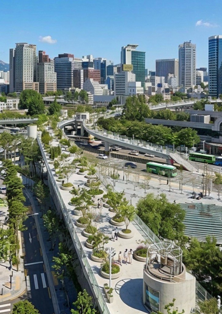
This is a path that transformed a 1970s vehicle overpass, which ran above the Seoul Station railway tracks, into a pedestrian-only green space. The name '7017' combines the year the overpass was first completed (1970), the year it was reborn as a pedestrian path (2017), the height of the overpass (17m), and the 17 pedestrian connecting paths that extend outwards. 'Seoullo' also combines the meanings of 'a representative pedestrian path for Seoul' and 'a path leading to Seoul.' The design was undertaken by the Dutch architectural group MVRDV, and the transformation into a pedestrian path was completed in May 2017. The total length is approximately 1,024m, and the width is about 10m. It is divided into a section that runs above the Seoul Station main line and a section on the ground towards Hoehyeon Station. The key feature is the structure where circular planters are lined up on the concrete deck, and trees and plants are planted inside, preserving the original structure of the road while adding greenery.
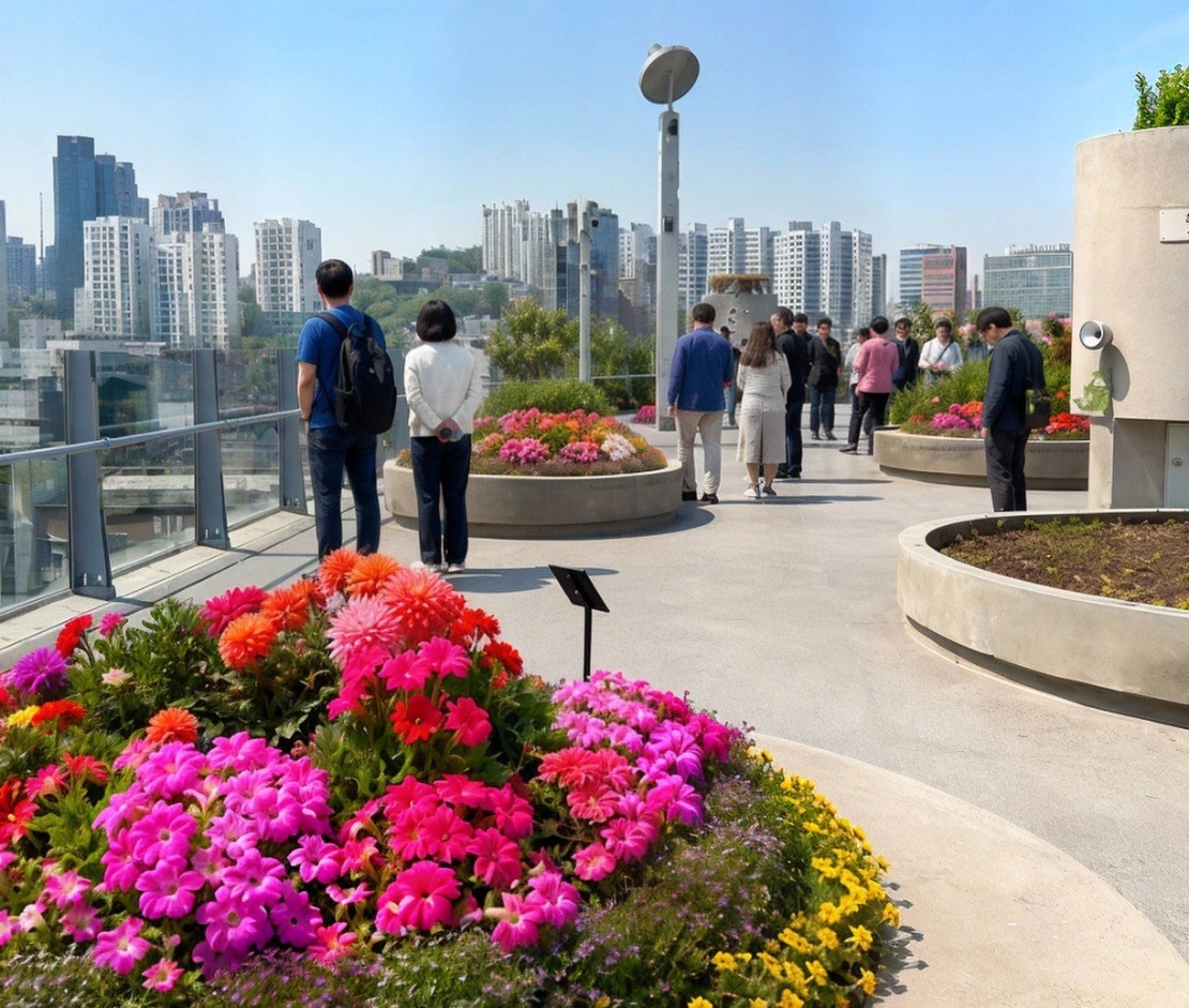
The most notable aspect is the way the plants are arranged. A total of 24,000 trees and herbaceous plants, belonging to 50 families and 228 species, are planted in 645 round planters, and they are arranged in alphabetical order by scientific name. As you walk from the beginning point near Hoehyeon Station to the end point near Manlijae, you can see plants of the same family grouped together, as if you were turning the pages of a botanical guide. The planters come in various sizes, and the largest ones are so wide that several adults would need to stretch their arms to encircle them, and they hold tall trees. Each planter has a label with the species name, making it easy to identify the plants, and the trees are selected so that you can see their leaves, flowers, fruits, and autumn colors throughout the year. The planters also include evergreen trees, so there are still green leaves even in winter. The height and diameter of the planters vary, so the eye level changes as you walk along the path, and the planters themselves are designed to serve as both seats and railings, creating a cohesive unit of planting, walkways, and rest areas.
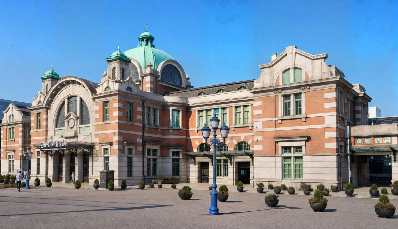
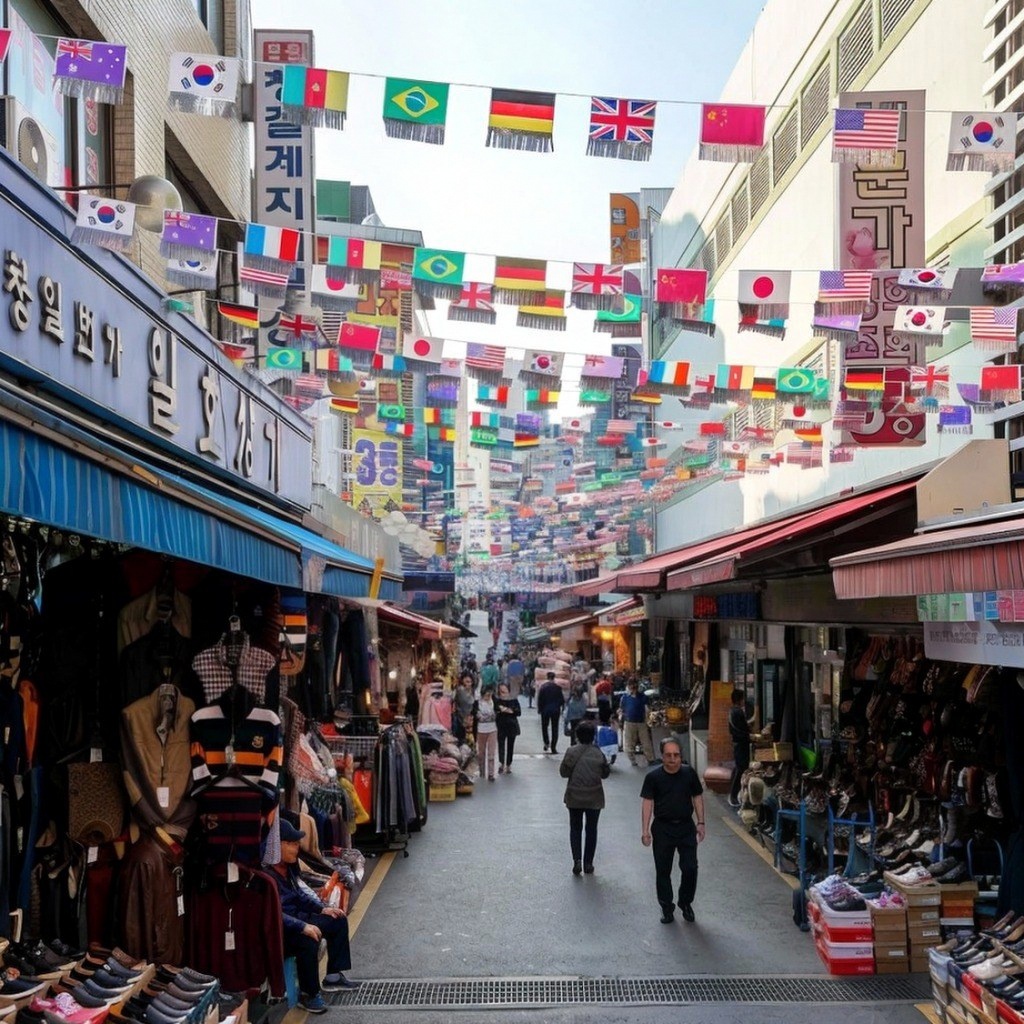
As you walk, you'll find public rest areas where you can take off your shoes and soak your feet, small stages named after plants like the Mokryeon Stage and Rose Stage, and interactive facilities like trampolines for children, all nestled among the flowerpots. This makes it more than just a path to pass through; it's a place to sit and relax. The upper surface of the walkway offers views of the Seoul Station railway, the high-rise buildings in the Namdaemun direction, and the low-rise residential area of Manlidan. As you follow the main path and descend towards Manlidan Square, you can extend your route to the square's flowerbeds and towards Son Gi-jeong Park. The 17 connecting paths branch out into six zones, leading to Namsan Overpass, Seoul Square, the bus transfer center, and Culture Station Seoul 284, which was renovated from the old Seoul Station. The connecting path towards Toegyero leads directly to Exit 5 of Line 4, Hoehyeon Station. If you head towards Hoehyeon Station, you'll find yourself entering Namdaemun Market. If you want to walk the entire elevated walkway without interruption, it's best to start at Exits 4 and 5 of Hoehyeon Station and walk along a single path towards Manlidan. Sit on one of the concrete benches attached to the flowerpots and take a closer look at the plants at your feet. You'll notice that even plants of the same species have different branching patterns depending on the location of the flowerpot and the direction of sunlight.
Gyeongju Daereungwon Tomb Complex
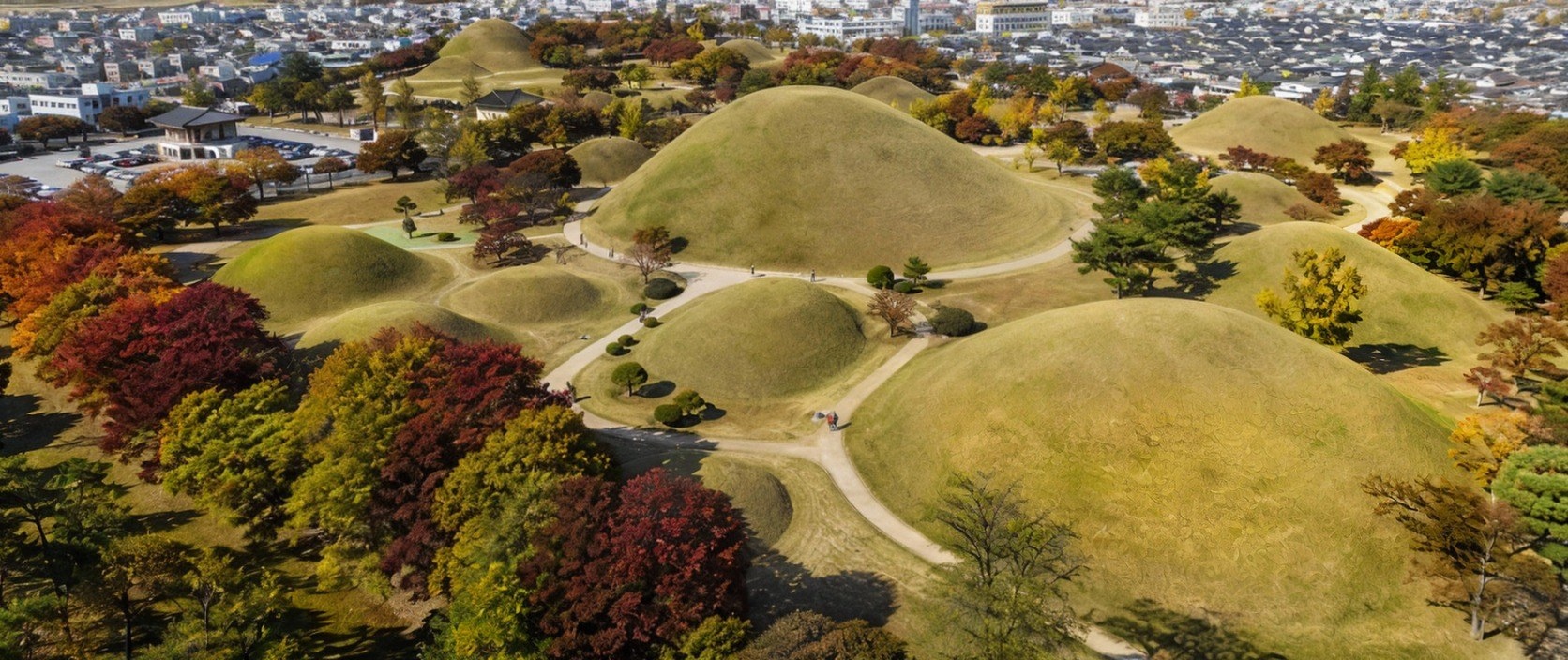
Daereungwon is a royal and aristocratic tomb complex consisting of 23 tombs from the Silla period, covering an area of approximately 126,000 square meters. It is located in the heart of Gyeongju City. The name of the tomb complex comes from the record in the "Samguk Sagi" that King Michu was buried in "Daereung" (Great Tomb), and it signifies a park where the tombs of kings, queens, and nobles are gathered in one place. The gently rounded earthen mounds are connected like grassy ridges, with dirt paths and lawns in between, allowing you to slowly walk around and explore the tombs. The most natural route is to enter through the main gate, first visit Cheonmachong, and then proceed to Hwangnamdaechong and Michureung in order.
We recommend starting with Cheonmachong. It is one of the few tombs among the 23 that has its interior open to the public. It was previously known as "Gyeongju Tomb No. 155," but after its excavation in 1973, it was named after the Cheonmachong mural found inside. You can see the cross-section of the burial chamber, which is about 47 meters in diameter and 12.7 meters in height. The chamber consists of a wooden coffin placed on top of a thick layer of stones, and then covered with soil. This type of tomb, called a "seokjok mokgwakbun" (stone-covered wooden coffin tomb), was difficult to rob, but the ceiling would eventually collapse over time, which is why many of the burial items have been found intact. Cheonmachong contained over 11,000 burial items, including a gold crown and a gold belt. When the horse tack piled up in the burial goods box was lifted, the Cheonmachong mural was revealed. The Cheonmachong mural is a painting on a birch bark base, depicting a white horse with its mane standing upright, flying in the sky. It was painted on the horse's saddle flaps to prevent dirt from splashing when the horse ran. It is considered one of the most important surviving paintings from the Silla period. In the exhibition hall, you can see the excavated cross-section of the burial mound, along with replicas of the gold crown and Cheonmachong mural, allowing you to trace the order of the stone mound, the wooden coffin, and the burial items.
Next, the Hwangnamdaechong Tomb, with its two burial mounds facing each other from north to south like gourds, is the largest tomb in Gyeongju. It is a massive double tomb, approximately 120m long from north to south, 80m wide from east to west, and over 20m high. The northern and southern mounds clearly show that they were built for different individuals. Excavations revealed that the northern mound contained a golden crown and a belt inscribed with "Bujindae" (meaning "belt for a lady"), suggesting it was a woman's tomb, while the southern mound contained mainly weapons, suggesting it was a man's tomb. Together, the two tombs yielded over 50,000 artifacts. The Michu Wangneung Tomb, said to be the tomb of the 13th king of Silla, houses Michu Isageum, a descendant of Kim Alji and the first of the Gyeongju Kim clan to ascend the throne. It has a diameter of over 50m and is surrounded by a wall, creating a separate enclosure, unlike other tombs. This allows one to easily understand the rules of Silla tombs, where the size and arrangement of the mounds, as well as the presence or absence of a fence, indicated the social status of the deceased. In the spring, a single magnolia tree standing alone between the tombs becomes a popular spot for people to take pictures with the curved lines of the mounds as a backdrop. Around the Michu Wangneung Tomb, cherry blossoms bloom in the spring, creating another picturesque spot.
After walking around the tomb complex, take a stroll along the stone wall path that surrounds the Daereungwon Park. Starting near the back gate, across from the Hwangnampang bakery, and following the stone wall for about 550m, you will reach the main gate. Outside the main gate, you will find Cheomseongdae, a national treasure and one of the oldest astronomical observatories in East Asia, which has stood in the middle of the field for over 1,300 years. You can closely examine the well-shaped upper part, the round body, and the stacked stones of the square window in the middle. Donggung Palace and Wolji Pond (formerly Anapji), the site of a Silla palace, are also within walking distance, making it easy to continue your journey. Donggung Palace and Wolji Pond are popular spots in the evening, as people gather to see the reflection of the pavilions in the pond. Therefore, it is a good idea to divide your day into a morning walk around the tombs and an evening walk along the pond.
Gamcheon Culture Village, Busan
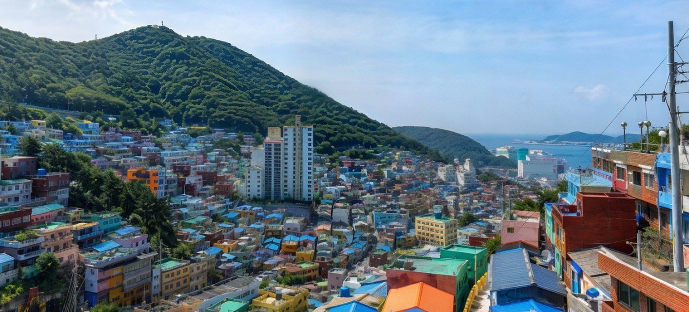
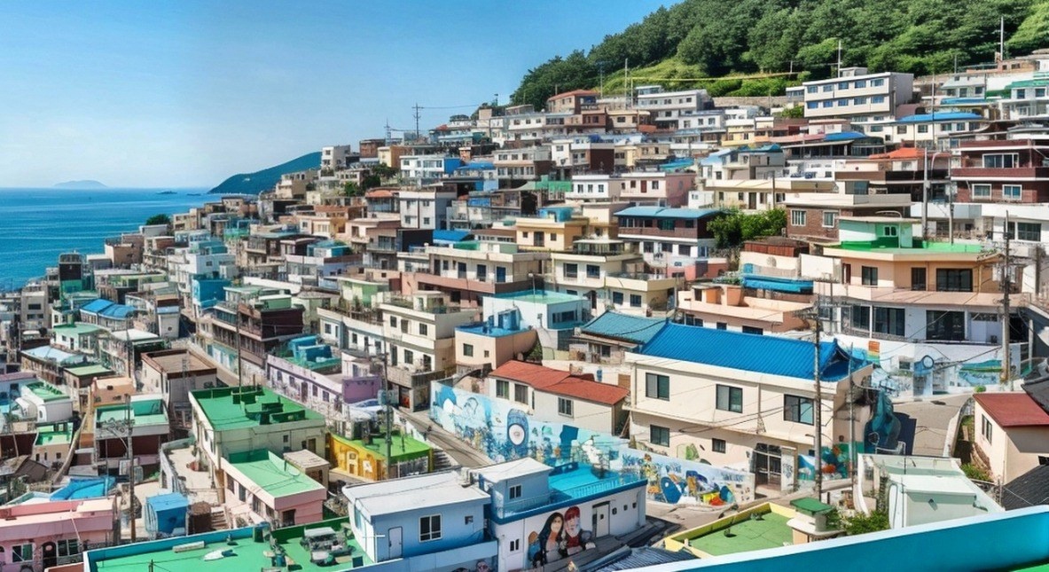
Gamcheon Culture Village is a hillside residential area in Gamcheon-dong, Saha-gu, Busan, which was formed during the Korean War. In the 1950s, thousands of followers of Taegukdo, a new religion, moved to the present-day Gamcheon 2-dong area and formed a religious village. This was joined by refugees from all over the country, and a terraced village was established along the hillside, with houses built on top of each other. This is where the village got its name as the "Taegukdo Village" or "Taegukdo Religious Village," and the Taegukdo headquarters is still located in the village. Because the houses were built with lower heights to avoid blocking the view of the houses behind them, when viewed from the opposite observatory, the colorful roofs create a terraced landscape that fills the hillside. This terraced landscape is the reason why the village is nicknamed "Korea's Machu Picchu" and "Korea's Santorini," and the fact that the alleys are intertwined like a maze is also mentioned.
The transformation of this once-neglected hillside neighborhood began in 2009 with the introduction of "culture." That year, students from Dongseo University's design department started painting murals on the alley walls. With support from Saha District, the project was selected as part of the Ministry of Culture, Sports and Tourism's public art project, "Dreaming Busan's Machu Picchu." Artists, residents, and students collaborated to decorate the empty houses and alley walls with murals and sculptures. The empty houses were repurposed as galleries, workshops, and guesthouses, and spaces like Gamnae Eulteo, a remodeled abandoned house, serve as accommodations for visitors who want to spend a night in the village. The village's most iconic photo spot is the "Little Prince and the Desert Fox" sculpture, located at the end of an alley, where the figures sit side-by-side, overlooking the village. This artwork depicts the Little Prince and the Desert Fox taking a break on their journey, and the terraced houses behind them create a picturesque backdrop, making it a popular spot for photos.
For those visiting the village for the first time, I recommend picking up a map from the information center and embarking on a stamp tour, collecting stamps from various locations throughout the alleys. As you follow the designated route, you'll naturally encounter galleries and viewpoints that might be easily missed from the main road, making it a great way to navigate the maze-like streets. When exploring the village, venture into the narrow alleys that are just wide enough for one person. Here are some things to look out for as you wander through the alleys:
- The different paint colors and handwritten signs on each exterior wall.
- The fish murals and small sculptures painted on the retaining walls of the staircases.
- The varying heights of the steps and the tiny courtyards between the houses.
- The small galleries, workshops, and stamp collection points located throughout the alleys.
By following these elements, you'll gain a better understanding of how the village was built to follow the contours of the hillside. Refer to the guide signs and alley maps at each intersection to find your way to the Little Prince sculpture, the viewpoints, and the galleries. There are many sections with stairs, so comfortable shoes are recommended. Also, remember that the inner alleys are still residential areas, so please be mindful and avoid looking into windows or courtyards.